Tax Code of the Russian Federation
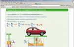
Flight levels are established from a conventional level that corresponds to the level of the Baltic Sea under a standard atmosphere (atmospheric pressure 760 mm Hg at an outside air temperature of +15° with a temperature gradient of 0.65° C and normal humidity).
The altitude of the flight level in flight is determined by the barometric altimeter by setting the “760” division of the barometric scale against the fixed index. Before takeoff, the crew is required to set the barometric altimeter(s) to “zero” altitude by setting the atmospheric pressure value (at the level of the take-off airfield runway) against a fixed index.
Setting the barometric pressure scale of the altimeter by dividing “760” against the fixed index is permitted only after reaching the transition altitude - the altitude of a rectangular route legalized for a given airfield. When approaching the airfield for landing approach, rearranging the barometric altimeter scale from a pressure of 760 mm Hg. Art. on the airfield altitude pressure is allowed to be carried out when leaving altitude eche
transition zone - the lower echelon of the landing aerodrome holding area.
Before landing at high-altitude airfields, when receiving on board a message about the atmospheric pressure at the airfield runway level being less than 670 mm Hg. Art. it is necessary to leave the “760” division on the baro scale
metric pressure against the fixed index, find the difference between barometric pressure 760 and the barometric pressure at the level of the landing airfield runway and express it in meters according to the standard atmosphere. The value found in this way will be the zero of the altimeter.
Organization and management of flights on international air routes. International routes are those that pass over the territories of two or more states.
Features of flights on international routes are determined by the rules and regulations established by the relevant states, including:
conditions for crossing state borders;
width of air routes; aircraft separation system;
restrictions and zones with special flight regimes;
on-board and ground documentation regulating flights;
aircraft navigation aids and rules. communications and signaling; time systems; fuel reserve standards; airfield network.

In all countries, traffic control services are government agencies and supervise the flights of all aircraft, including foreign ones.
Communication with aircraft is carried out mainly on ultrashort waves via radiotelephone in the languages established for the territories of these states.
In countries that are part of the international
Civil Aviation Organization (ICAO),
Radio communications with foreign aircraft are conducted in English.
When performing international flights, each aircraft must have:
certificate of fitness to fly;
approved flight plan; weather bulletin.
The rules for flying over different foreign countries are different. Detailed information about the conditions, patterns and routes of flights on individual international routes are presented in special collections published by the aviation information service of the Ministry of Civil Aviation of Russia (SAI MGA).
In countries that are members of ICAO, air traffic management is primarily of an informational nature. The crew is given only the altitude, the exact time of departure and arrival, and sometimes the time of passage of the checkpoints. The remaining data is transmitted on board the aircraft in the form of information, on the basis of which the crew makes independent decisions regarding the execution of the flight.
Foreign air routes are typically 10 nautical miles (18.52 km) wide. This value determines the required accuracy of aircraft navigation.
In the states that are members of ICAO, units of measurement are used on air routes that differ from those adopted in Russia. Therefore, aircraft crews on international flights must have tables or graphs for converting one unit of measurement to another.

Units of measurement accepted in countries that are members of ICAO and in Russia. The Blue Table column refers to those countries that have not yet fully adopted ICAO recommendations on units of measurement.
Foreign aircraft separation systems. Apply in different countries various systems separation. One but for international flights almost everywhere the basic one, borrowed from Russia , the principle of calculating barometric separation altitudes from the level of an isobaric surface corresponding to a standard pressure of 760 mm rgp. Art.
The distribution of separation altitudes depending on the direction of flight in different countries may be different. Semicircular and quadrant systems are used.
The semicircle system is used mainly in Russia and the USA. In the USA, for flight altitudes up to 29,000 feet, the intervals between passing flight levels are assumed to be 2000 feet, and between oncoming flights - 1000 feet. For flight altitudes of 29,000 feet and above, the corresponding intervals are doubled. When flying in the direction of track angles from 0 to 179°, i.e. to the east, separation altitudes are assigned that are multiples of odd numbers of thousands ft. For flights with track angles from 180 to 359°, i.e. to the west, even flight levels are assigned.
In some countries that are members of ICAO, including England, Belgium, Denmark, Sweden, Holland, etc., a quadrant system has been adopted, according to which, at altitudes up to 29,000 feet, tailwinds echelons differ by 2000 feet, and counter levels by 1000 feet. Flight levels for flight directions corresponding to adjacent quadrants differ in altitude from one another by 500 feet.
At altitudes above 29,000 feet the corresponding intervals double.

As a result of the research, the following was established:
in the place where induction or magnetic sensors are installed on modern aircraft with gas turbine engines, the deviation does not exceed deviation work on airfields with reinforced concrete pavement; it cannot be carried out, since there are local anomalies that cause changes in the readings of magnetic compasses and heading systems up to ±5-f- 8°;
Replacing gas turbine engines on airplanes does not affect the accuracy of the heading systems and remote compasses.
On this basis, special instructions have been issued for various types heavy transport aircraft with gas turbine engines, according to which:
deviation work is excluded from routine maintenance of these aircraft;
the deviation device has been removed from the sensors of remote compasses and heading systems;
the installation error of the sensors is determined by rotating the sensor until the course readings according to the navigator's pointer coincide with the magnetic course of the aircraft, determined by double direction finding of its longitudinal axis (from the nose and tail).

Compensation for instrumental errors of directional devices is performed without rotating the aircraft in the following order.
A) On aircraft equipped with KS heading systems and the GIK-1 gyroinduction compass: remove the induction sensor from the aircraft and attach it to the rotating antimagnetic platform from the UPK-3 kit. Connect the sensor to exchange rate system transition harness. Install the antimagnetic installation platform with a sensor mounted on it on the wing of the aircraft above the place where the induction sensor is attached or on a tripod when the installation is brought to the ground;
set the zero reading on the scales of the navigator’s indicator and the correction mechanism.
The average error of remote transmission in the sensor-CM section is determined in the following order:
zero readings are set on the scale of the antimagnetic installation and the correction mechanism (CM);
course readings are taken on the KM scale when the antimagnetic installation is rotated to courses of 90, 180 and 270° and determining corrections for each course;
the sum of corrections on the main courses is divided by four and the average error of remote transmission is determined;
the zero reading on the diamagnetic installation is corrected by the value of the average error, and the heading “0” is set on the USH.
After taking into account the average error, the diamagnetic installation is sequentially set to courses of 15, 30, 45, etc. up to 345°, and with the help of a pattern device, the course readings on the USH are brought respectively to 15, 30, 45, etc. up to 345° when the quick button is pressed approvals
b) On aircraft equipped with a remote magnetic compass having a PDK-3 type sensor: instrumental errors are compensated by rotating the magnetic system of the PDK-3 sensor through 15° on the sensor scale. The magnetic system is rotated without removing the sensor using any magnetic bar;
If there is a discrepancy in the angle grinder readings with the course readings on the scale of the PDK-3 sensor, it is necessary to use a pattern device to bring the heading readings on the angle grinder to the course readings on the PDK-3 scale.
Radio deviation compensation. The deviation of the radio compass is compensated by a mechanical* compensator installed on the axis of rotation of the loop antenna.
The guide tape, through a special transmission mechanism, creates an additional rotation of the selsyn sensor axis. Using 24 compensation screws, the guide strip is given the shape necessary for reading radio compass readings through 15° of the scale (from 0 to 360°).
Before determining the radio deviation, the compensator should be neutralized by unscrewing each screw so much that the guide tape takes on a ring shape (the additional rotation of the selsyn sensor axis at all heading angles is zero).
To determine radio deviation, it is recommended to select a radio station at a distance of 50-60 km. After determining and eliminating the installation error of the radio compass at the readings (ORC) of 0 and 180°, the readings should be taken by rotating the aircraft and stopping it at the ORC, a multiple of 15°. At each ORK reading, the actual heading angle of the radio station is determined and the radio deviation is recorded.
Then a radio deviation graph is constructed, and to avoid sharp bends in the tape, the extreme values of the graph are divided into three equal parts and two intermediate radio deviation graphs are constructed. After this, the compensator is removed from the frame axis and by rotating the corresponding screws, the radio deviation is compensated according to the first intermediate graph, counting the correction entered on this ORK according to a special arrow on the compensator. Having compensated for radio deviation according to the second intermediate schedule, it is finally compensated according to the radio deviation curve.

Compensation for radio deviation according to all three graphs should be performed in such an order that after introducing each positive correction, the same negative value would be entered, i.e., as if in a mirror image of heading angles.
The general compensation order is as follows: 0°, 15, 345, 30, 330, 45, 315, 60,300, 75, 285, 90, 270, 105, 255, 120, 240, 135, 225, 150, 210, 165, 195 and 180°.
After compensating for radio deviation, the compensator is installed on the frame mechanism and, by rotating the aircraft, the correctness of the work is checked. If an inaccuracy is detected, radio deviation is decompensated by additional rotation of the screws with appropriate ORC.
It is unacceptable to determine radio deviation on the ground on airplanes that have an AR K loop antenna installed in the lower part of the fuselage. This is due to distortion electromagnetic field electromagnetic waves, reflected from earth's surface. In such cases, radio deviation is determined in flight, choosing for this purpose a radio station 200-300 km away from the flight area.
An aircraft performing such a flight must cross the line of a given bearing at each reading of the radio station's heading angle. It is convenient to take the order of heading angles in flight as indicated for compensating for radio deviation on the compensation mechanism, and up to the EAC of 270-90° the aircraft approaches the radio station and then moves away from it.
In order to reduce time, you can fly along a 24-angle route, i.e., almost in a circle, switching to a 20-angle
30 seconds in straight flight with each reading of the radio compass and heading. It should be remembered that here at each reference point it is necessary to determine the MS and plot it on the map for calculation when
processing of radio station bearing data from the reference point.
With both methods, the actual heading angle of the radio station at the moment the reading is taken is determined by the formula
Compensation for radio deviation is carried out after landing in the same manner as when determining it on the ground, but without checking the accuracy of the work, since a repeat flight would be required.
Each aircraft has a standard radio deviation graph, which, if necessary, is applied to the frame pattern.
On the transition to the ICAO vertical echeloning system and abbreviated intervals of vertical echeloning (RVSM) from a train 290 to the echelon 410 inclusive in the airspace of the Russian Federation from November 17, 2011
1. System of vertical separation of aircraft in airspace Russian Federation, corresponding to Table a) of Appendix 3 of Annex 2 to the Convention on International Civil Aviation, will be introduced throughout the airspace of the Russian Federation at 00.00 hours. UTC November 17, 2011
2. Aircraft operators intending to operate in the airspace of the Russian Federation with RVSM must have aircraft equipped in accordance with the requirements for minimum airborne systems performance (RVSM MASPS), and aircraft approval for flights in RVSM conditions.
A permit to fly under RVSM conditions, issued in any ICAO region, will be valid for flights in the airspace of the Russian Federation under RVSM.
3. For aircraft not allowed to fly under RVSM conditions and not being state aviation aircraft, ATS units assign flight levels below RVSM airspace.
4. To operate flights in the airspace of the Russian Federation, the aircraft flight plan (FPL) must be provided to ATS authorities with reliable information about the aircraft’s approval for flights under RVSM conditions.
5. Before the start of each flight in the airspace of the Russian Federation and over the open sea in the area of responsibility of the Russian Federation (RIR), an FPL must be transmitted no later than 3 hours before the departure time of the aircraft in accordance with the requirements of the Russian AIP.
If there is a change in the aircraft operating the flight and the designated RVSM approval status changes, the operator will submit a new FPL.
All operators of RVSM approved aircraft indicate approval status by entering the letter “W” in Item 10 of the ICAO flight plan, regardless of the requested flight level.
When planning flights in the airspace of the Russian Federation with RVSM, operators of state aircraft enter the letter “M” into paragraph 8 of the ICAO flight plan.
All operators of government aircraft not approved for RVSM flights, when requesting flight level 290 and above, enter the designation “STS/NONRVSM” in paragraph 18 of the ICAO flight plan.
With the exception of government aircraft, aircraft operators intending to conduct a formation flight shall plan such flight outside RVSM airspace:
Do not include the letter “W” in paragraph 10 of the ICAO flight plan, regardless of the approval status for RVSM flights of aircraft included in the group of aircraft;
Enter the designation “STS/NONRVSM” into Item 18 of the ICAO flight plan.
6. Vertical separation of aircraft in the airspace of the Russian Federation will be carried out at established intervals, expressed in meter units relative to the altitude below the transition level, and through flight levels (FL) when flying at the transition level and above.
When conducting two-way air-to-ground radio communications between an aircraft crew flying at a flight level and an air traffic controller, numerical values of flight levels (FLs) will be used in accordance with Table a) of Appendix 3 of Annex 2 to the Convention on International Civil Aviation.
When conducting two-way air-to-ground radio communication between the crew of an aircraft flying below the transition level and the air traffic controller, flight altitude values expressed in meters will be used, and the unit of measurement must be indicated - meters.
The vertical position of an aircraft flying in the area of an aerodrome below the transition level will be specified by the air traffic controller and reported by the crews in relative altitude (QFE) values in meters.
ICAO cruising levels are applied throughout the airspace of the Russian Federation, and from flight level 290 to flight level 410 inclusive, reduced vertical separation intervals (RVSM)*,*** are applied.
*Reduced vertical separation minima(English) Reduced vertical separation minima (RVSM)) - a system of measures designed to increase throughput airspace by reducing the established intervals between flight levels. Already introduced in many countries, including Russia, it provides for intervals of 1000 feet between levels in the upper airspace (in the range FL290 - FL410).
· In the airspace of the Russian Federation, the following minimum vertical separation intervals are established for aircraft flights under instrument flight rules:
a) 300 m – to flight level 12500 m (flight level 410);
b) 600 m – above flight level 12500 m (flight level 410).
· In the airspace of the Russian Federation with reduced vertical separation interval (RVSM) from flight level 8850 m (flight level 290) to flight level 12500 m (flight level 410) inclusive flights of aircraft not approved for flights with reduced vertical separation interval (RVSM) are prohibited, except for state aircraft, aircraft flying as part of a group, aircraft that, for any reason, have lost the ability to maintain a given flight level in flight, including those flying with a faulty radio connection. In these cases, a minimum vertical separation interval of 600 m is established between the specified aircraft.
· The procedure for admitting aircraft and operators to flights with reduced vertical separation interval (RVSM), as well as monitoring the altitude characteristics of aircraft (monitoring) is determined by the Ministry of Transport of the Russian Federation.
· The minimum vertical separation interval between aircraft operating under visual flight rules above the transition level to flight level 8100 m (flight level 265) is set to 300 m.
· The minimum vertical separation interval above the transition level between aircraft flying under visual flight rules and aircraft flying under instrument flight rules must be at least 300 m.
When flying below the lower flight level, the vertical distance between the lower flight level and the flight altitude must be at least 300 m.
The vertical distance between the circling altitude and the lower level of the holding area must be at least 300 m.
The vertical distance between aircraft in the airfield area must be at least 300 m. For class 4 aircraft and helicopters flying under VFR (VFR) below the lower flight level, at intersections with flight routes of class 1, 2 and 3 aircraft at radar control and a longitudinal distance between them of at least 5 km; the vertical interval must be at least 150 m.
Assign simultaneously the same flight level (altitude) for aircraft flights under VFR and IFR (IFR) prohibited.
Vertical separation in the airspace is carried out using a semicircular system relative to the true meridian according to the appendix.
In the area of the controlled aerodrome, in the aerodrome control service area, in the approach control service area and in holding areas, vertical separation is established regardless of the direction of flight of the aircraft.
The minimum vertical separation interval between aircraft flying at supersonic speeds, as well as between aircraft flying at supersonic and subsonic speeds, should be 1000 m.
The minimum interval between the transition level and the transition altitude must be at least 300 m.
When changing the flight level at a turning point on the route, due to a change in the general direction of the flight, the new flight level must be taken 20 km before passing the specified point, with the permission of the dispatcher, in compliance with the established intervals.
If the specified true track angles of most sections of the route (route) are within one semicircle, and individual sections are within another, then single flight levels can be established for the entire air route (route), subject to compliance with flight safety measures.
In the area of the airfield (air hub) and in holding areas, vertical separation is carried out in accordance with established intervals, regardless of the specified flight path angles.
**The direction of the track line is determined by true north.
***Due to the fact that in the Russian Federation units of quantities are used International system units (SI) adopted by the General Conference on Weights and Measures and recommended for use International organization In legal metrology, absolute heights, elevations and relative heights are measured in meters. To support flights of aircraft equipped with vertical separation means that measure altitude in non-system units, the Russian Federation allows the measurement of absolute and relative altitudes in feet (ft). The assignment of flight level by the ATS unit is carried out in flight level numbers.
vertical separation- dispersion of aircraft in altitude at established intervals;
longitudinal separation- dispersal of aircraft at the same altitude at specified intervals in time or distance along the track;
lateral separation- dispersion of aircraft at the same altitude at specified intervals by distance or angular displacement between their tracks;
Chapter 30. Rules of vertical, longitudinal and lateral separation in controlled airspace 384. Vertical separation intervals are established: 1) from level 900 to level 8 100 m - 300 m; 2) from flight level 8,100 to flight level 12,100 m - 500 m; In the area of the airfield (air hub) and in holding areas, vertical separation is carried out in accordance with established intervals, regardless of the specified flight path angles. Paragraph 1. Minimum longitudinal intervals separation during VFR flights 393. Between aircraft following the same route at the same echelon (altitude) - 2 km. 394. At the moment of crossing a flight level (altitude) occupied by another aircraft, as well as crossing a flight route at the same flight level (altitude): 1) 2 km for aircraft with flight speeds of 300 km/h or less; 2) 5 km for aircraft with flight speeds of 301-550 km/h. ^ Paragraph 2. Minimum longitudinal separation intervals when flying under IFR and VZP rules with 395. Between aircraft following the same route at the same echelon (altitude): 1) on air routes, international routes and along established routes - 30 km; 2) in the approach zone - 20 km; 3) in the approach zone when using ATC automated systems - 10 km; 4) in the take-off and landing zone - 10 km for all aircraft following aircraft with a take-off weight of 136 tons or more. In all other cases - 5 km. 396. When crossing an oncoming flight level (altitude) occupied by another aircraft - 30 km at the time of crossing (subject to a 10-kilometer lateral interval). 397. When crossing a passing flight level (altitude) occupied by another aircraft - 20 km, and in the approach zone when using ATC automated systems - 10 km at the time of crossing. 398. Between aircraft following intersecting routes (at intersection angles of at least 70°) at the same flight level (altitude) - 40 km at the time of intersection. Paragraph 3. Minimum longitudinal intervals separation according to IFR (special VFR) in the absence continuous radar monitoring 399. Distance-based longitudinal separation minima when using DME are maintained by maintaining a distance(s) between reported positions of aircraft determined by DME in conjunction with the use of other suitable navigation aids that shall not be less than specified values. When using such separation, direct radio communication is maintained between the pilot and the air traffic controller. For aircraft flying along the same track and located at the same (cruising) flight level, longitudinal separation minimums are established: 40 km. Provided that each aircraft uses DME stations located along the track and separation is verified by simultaneously receiving DME readings from aircraft at short intervals to ensure compliance with the minima. 400. Between aircraft following the same route at the same echelon (altitude): along air routes, international routes, along established routes and in the approach zone - 10 minutes; when performing a maneuver according to the approach pattern in the takeoff and landing zone - 3 minutes. In the absence of continuous radar control, lateral separation during IFR flights is prohibited.
^ Paragraph 4. Minimum time intervals longitudinal separation according to IFR and VZP rules when lack of continuous radar monitoring TSM Woodworking Plant is engaged in production of house kits from profiled timber with natural humidity , development of projects and construction of houses, baths, gazebos made of profiled timber own production V Nizhny Novgorod construction material with excellent technical characteristics. Automatic quality control guarantees strict compliance of the produced timber with the most stringent building regulations and requirements.
Thanks to a stepwise raw material processing system profiled timber acquires such properties as increased strength, resistance to corrosion and deformation processes, and fire resistance. At the same time, the original qualities of natural wood are preserved: aesthetics, low thermal conductivity, environmental friendliness, not to mention the fact that wooden houses They have a special energy of warmth and calm. Being a natural material, profiled timber does not require any additional finishing, and in itself is a decoration of any structure.
Houses, bathhouses, gazebos made of profiled timber
All these qualities make profiled timber excellent material for construction wooden houses, bathhouses, gazebos. Even the aggressive effects of high humidity, high and low temperatures characteristic of Nizhny Novgorod region, “don’t care” about this material. A house made of profiled timber will serve you for many years, embodying your dream of an ideal place to live. A bathhouse and a gazebo made of timber will become a harmonious addition to the ensemble, combining practicality and aesthetics.
Another area of activity of our company is drying wood of various species according to favorable price and in any volume! The drying process takes place in special convection chambers under strict adherence to temperature and humidity conditions. The drying time depends on the type of wood and volumes of lumber, and usually ranges from 7 to 10 days, depending on the time of year.
According to the organization's latest estimates Eurocontrol, the number of flights in the European region in 2014 will exceed 2013 by 1.8%, and by 2020 will reach 11 million flights, that is, almost 20% more than in 2013. Already at the end of the 80s of the last century, it became clear that the constant growth in the volume of air transport poses a challenge to the world civil aviation serious problem, namely the acute shortage of air space. There was a need to look for new, more rational and effective approaches to its use, in other words, to somehow tighten air traffic. The first step in this direction was the active use of the navigation method, that is, area navigation, as well as the establishment of rather strict ones in the busiest regions, which made it possible to significantly reduce the lateral intervals between aircraft. In parallel with the introduction of RNAV, the issue of reducing the interval between aircraft in the vertical plane was actively studied. ICAO has developed a concept to reduce vertical separation intervals in the upper airspace between levels FL290 and FL410 from 2000 feet to 1000 feet, that is, 300 meters, this concept is called RVSM – reduced vertical separation minimum or reduced vertical separation intervals.
Implementation.
Implementation of a separation system RVSM began in 1997 with the North Atlantic region, where vertical separation intervals between FL330 and FL370 were first reduced to 1000 feet. Since 2000, there has been a massive transition to RVSM intervals around the world. By 2005, the RVSM system had already been installed in almost the entire European region and the Western Hemisphere, and in 2011 in Russia.
To date, all ICAO member countries have installed in their airspace RVSM between echelons FL290 and FL410. Standing apart are China, Mongolia and the DPRK, which refused to switch to the foot height measurement system, however, introduced RVSM in meter units.

Separation system in the Russian Federation. RVSM echelons are highlighted in green.
Requirements for equipment and crew.
To perform flights using separation RVSM aircraft must have appropriate authorization issued by the aviation authorities of the country of the operator, and flight crew members must undergo special training.
The aircraft must have the following serviceable equipment:
- two independent height measurement systems;
- transponder with the function of transmitting the current flight altitude (Mode C Transponder), as well as TCAS;
- warning system for deviation from a given flight level with a response threshold of 300 feet;
- autopilot with the function of maintaining a given altitude (ALT HOLD).
Features when submitting a flight plan.
When submitting a flight plan for an aircraft approved for RVSM, the index must be indicated among other equipment W, which means RVSM approval. If for some reason there is no such clearance, the flight plan must be submitted indicating the flight level below FL290.

Example of a flight plan for an aircraft with RVSM approval.
Equipment failure on the ground or in flight.
In the event that the equipment necessary for a flight using separation fails RVSM, the crew must immediately report this to the dispatcher, or, if on the ground, submit an amended flight plan; such malfunctions include:
If the situation allows, the dispatcher will provide an interval CVSM(conventional vertical separation minimum) equal to 2000 feet and will give the command to maintain the current flight level. However, if the loss of RVSM status occurs in congested airspace, a descent below FL290 will most likely be ordered.
Flight in a turbulence zone.
If the aircraft encounters turbulence severe enough to cause the autopilot to disengage, or to deviate from the assigned altitude by more than 65 feet, the crew informs the controller about the impossibility of maintaining RVSM intervals due to turbulence. The controller acts in the same way as in case of loss of RVSM clearance status, however, the aircraft is not considered to have lost this status. Once the aircraft leaves the turbulence zone and the flight altitude can again be maintained at automatic mode with the required characteristics, the crew makes a report on readiness to resume the RVSM flight.